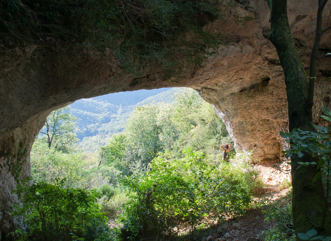
Le pont des Sarrasins
Ajouter au carnet de voyage
- Distance8,1 km
- Duration3h40
- DifficultyDifficult
- Total altitude change+ 445 m
- Departure/arrivalChâteaudouble
- Route markingYes
After a tough climb, discover a geological curiosity. This natural arch evokes many legends: a hideout for Saracen invaders, a secret mine of metal or precious stones, or the work of a giant...
- Address26120 Châteaudouble
Drôme Tourisme cannot be held responsible for any problems encountered along the route.
Any problems encountered can be outlined here:
Author: Conseil Départemental de la Drôme - Apidae Tourisme
To show the map
0M
0M