Montrebut et Isnards
Ajouter au carnet de voyage
- Distance12,1 km
- Duration3h47
- DifficultyDifficult
- Total altitude change+ 338 m
- Departure/arrivalBeausemblant
- Route markingYes
Between the Rhône and Galaure valleys, this varied hike offers panoramic views of the natural environment from the Montrebut and Isnards plateaus.
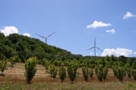
Sur la Boucle : étang de Tholière, château de Beausemblant, Chapelle Sainte Euphémie, éoliennes.
- AddressPArking étang de la Thiolière, route du stade
26240 Beausemblant - Phone04 75 23 45 33
- Emailporte@dromardeche.fr
- WebsiteSee the website
Our tips
- Details about route marking :
Peinture jaune - Références topographiques :
Topoguide FFRP Drôme des collines
Drôme Tourisme cannot be held responsible for any problems encountered along the route.
Any problems encountered can be outlined here:
Author: Conseil Départemental de la Drôme - Apidae Tourisme
To show the map
0M
0M