Les routes du vertige
Ajouter au carnet de voyage
- Distance127,6 km
- Duration8h
- DifficultyVery difficult
- Total altitude change+ 3220 m
- Departure/arrivalLa Chapelle-en-Vercors
- Route markingYes
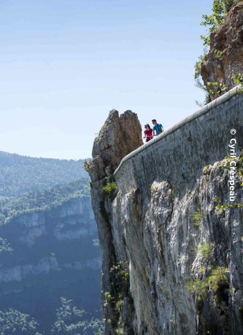
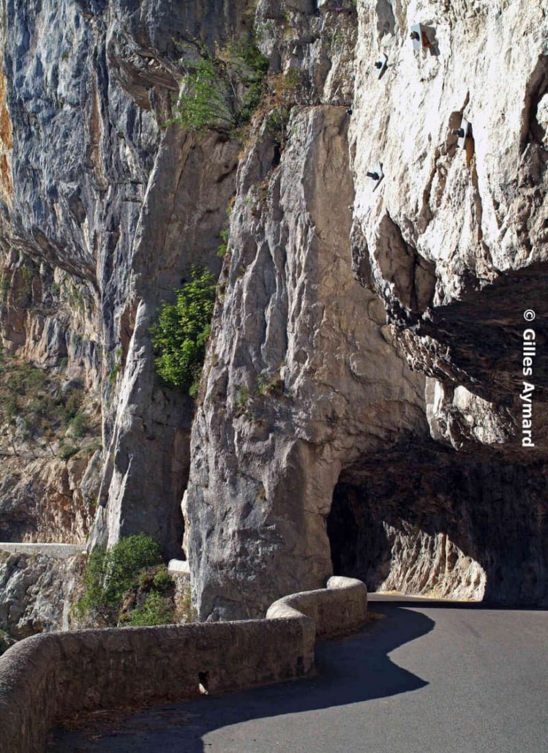
This 68km route with 3220m of ascent is a real challenge for cyclo-sportifs, just like the vertiginous route itself. The Vercors, an inaccessible citadel. Discover the spectacular and daring aspects of these "sublime roads".
- Address26420 La Chapelle-en-Vercors
- Phone04 75 48 22 54
- WebsiteSee the website
Drôme Tourisme cannot be held responsible for any problems encountered along the route.
Any problems encountered can be outlined here:
Author: Conseil Départemental de la Drôme - Apidae Tourisme
To show the map
0M
0M