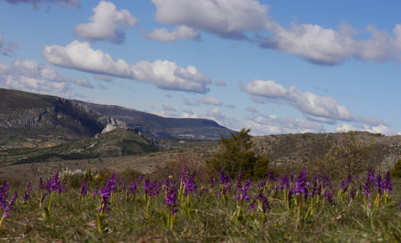
Montagne de Buc depuis Barret
Le pastoralisme est aussi le garant de la diversité des paysages que l’on connait aujourd’hui. Merci de respecter cette activité lors de vos randonnées.
Départ : Barret-de-Lioure, alt.950 m, parking devant la mairie.
1. Entrer dans le village par la rue de la Bourgade, prendre directement à gauche sous le soustet (« Rue du calvaire »). Dos à l’église, descendre à gauche puis à droite derrière une maison pour rejoindre une petite route goudronnée. Prendre légèrement à gauche au prochain embranchement.
Arriver dans une cour près d’un lavoir, prendre en face un chemin herbeux. A l’intersection, remonter à droite et atteindre la D 542.
2. Emprunter la route à gauche sur 800 m (soyez prudent, route fréquentée) jusqu’au carrefour « Le Riou, alt.800 m ».
3. Quitter la D 542 et emprunter la petite route à droite à la montée qui se transforme en piste au bout de 550m. Au carrefour de la « Croix du Jas »,
continuer de monter à droite. Rester sur la piste principale sur 2.3 km, passer devant les chenils au lieu-dit « Eyrolle ». La piste va peu à peu évoluer en
milieu ouvert et rejoindre un carrefour d’itinéraire.
4. Laisser le chemin venant du col des Arles et continuer tout droit pour atteindre un second embranchement : « Les Plaines, alt.1100 m ».
5. De là, bifurquer à droite à 90°, le sentier monte dans la lande le long d’un champ cultivé pour rejoindre un croisement. Prendre le raidillon caillouteux plein est. Vous entrez dans une zone pastorale, rester loin des troupeaux. Continuer dans la même direction jusqu’au sommet de la « Montagne de Buc, alt.1142 m » signalé par une borne géodésique. Vue à 360°.
6. Amorcer la descente plein nord sur 700 m.
7. Bifurquer à droite sur une piste qui descend sur la droite. Au 3e lacet, ignorer la piste à gauche et continuer dans la même direction. L’itinéraire monte et descend en sous-bois jusqu’à ressortir en milieu ouvert à l’approche d’une bergerie.
8. Continuer tout droit au carrefour de « Serrière de Piberos, alt.1179 m » en direction de Bergiès (montagne avec les coupoles au sommet) pour arriver au petit col (alt.1157 m).
9. Descendre à droite ; marcher 300 m et surveiller le départ d’un chemin à droite signalé par un cairn au niveau d’un replat herbeux.
10. L’emprunter, celui-ci évolue à flanc de montagne avec de magnifiques vues sur la montagne de Buc et le village de Barret-de-Lioure.
11. Arrivé sur une piste la suivre sur quelques mères à gauche puis prendre le chemin à droite qui rejoint le parking de départ.
- Address26570 Barret-de-Lioure
Drôme Tourisme cannot be held responsible for any problems encountered along the route.
Any problems encountered can be outlined here:
Author: Conseil Départemental de la Drôme - Apidae Tourisme

