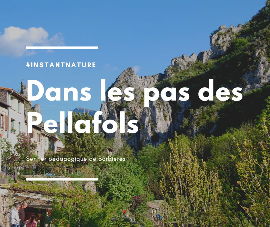
Sur les pas des Pellafols
- Distance4 km
- Duration1h15
- TypeOutward and return
- DifficultyVery easy
- Total altitude change+ 100 m
- Departure/arrivalBarbières
- Route markingYes
Village interpretation trail. A playful map and mischievous little elves, the Pellafols, have been placed on the panels to help children discover the village. To be done with the game leaflet, available from your tourist office.
Over a 4 km stretch, 14 information panels mark out the route, enabling visitors to learn more about the industrial history of this rural village, with its 19th-century lime kilns and the kaolin factory that flourished until the 2000s.
Not to mention the local flora and fauna.
The tour was initiated by Valence romans agglo and the commune of Barbières, with support from Cairn, a consultancy specializing in heritage interpretation.
Route :
Start from the parking lot on the left before the town hall.
At the church, turn right and walk along the church, down the stairs.
On the left, walk along the small stream, listening to the wind and the birds.
Go down into the small park on the right, where picnic tables and benches are set up.
(The nearby river is an enchantment - watch out for younger children).
Go up to the top of the park and cross the path, following the sign.
Once you've reached the main road, turn right.
Continue along the main street, past the bridge and straight ahead. Take a look to your left to admire the climbing site.
Continue to the next bridge. Just before it, take the tarmac track on your left.
This leads to a gravel path.
You may be lucky enough to see horses along the way, as well as insect houses, oak trees and butterflies fluttering around you.
You'll also be able to hear the trees creak in the breeze.
On the trail, you'll come to a gate. Open it, but above all close it behind you.
Continue along the path and, if you're doing it in fine weather, enjoy the colorful expanse of daisies, irises, pines and other flowers along the way (please do not pick the flowers, and respect the flora and fauna).
At the last signpost, as indicated, turn around!
An alternative route is to take the bridge (at the rock-climbing site) on the left, which takes you back to the riverside near the park at sign no. 2.
Return along the original path to signpost N°1 (remember to turn right at the church) and listen to the frogs singing in the stream...
- AddressDépart Parking
15 rue de la Bise
26300 Barbières - Phone04 75 44 90 4004 75 02 28 72
- WebsiteSee the website
Drôme Tourisme cannot be held responsible for any problems encountered along the route.
Any problems encountered can be outlined here:
Author: Conseil Départemental de la Drôme - Apidae Tourisme